
“I sincerely hope these maps make the Commission’s job easier and help create a better outcome for the whole process,” said Currier.
***Update***
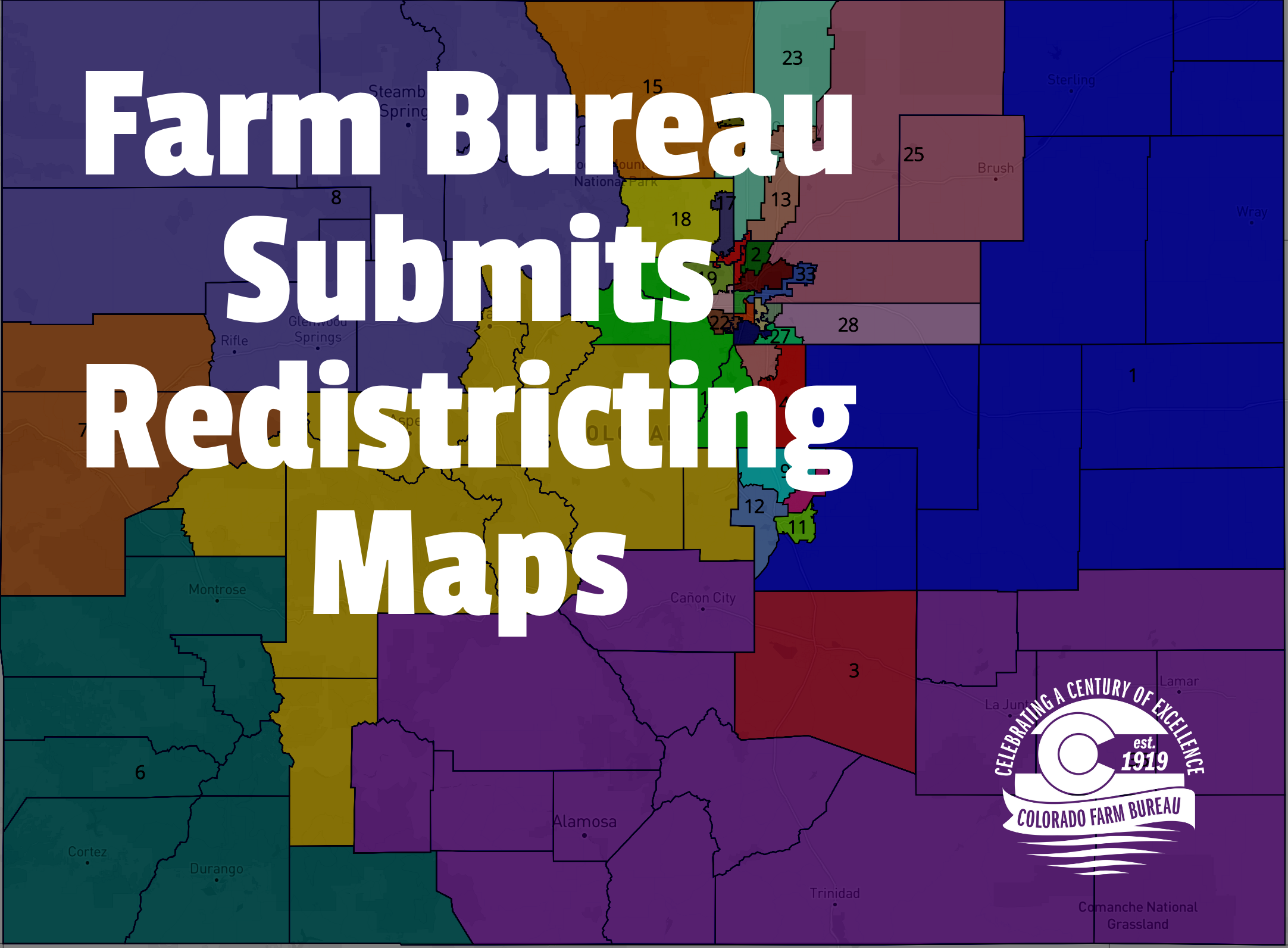
CFB has submitted updated maps to the Legislative Commission that include prisoner reallocation data. The maps also refine the boundaries of some districts to better align them with the underlying agriculture industry in the region. The comments to the Commission with links to the proposed maps can be read here.
The Colorado Farm Bureau recently submitted two maps that take a fresh look at Colorado’s legislative districts as a part of the public comment process of the Colorado Independent Redistricting Commissions. CFB strongly supported the constitutional amendments Y and Z in 2018 that created the new redistricting body and required maps to be drawn to align communities of interest and increase competitiveness. The CFB-submitted maps propose new ideas for Colorado’s state Senate and state House boundaries that help ensure better and more equitable representation for rural Colorado and racial minorities.
“This is a vital part of our civic process, and we didn’t want to miss our chance to give voice to rural Colorado,” said CFB President Carlyle Currier, a rancher from Molina. “No map is perfect, but ours were drawn with the spirit of Amendments Y and Z as our priority. As drawn, our districts are compact, diverse and respect the state’s regional and social communities of interest,”
CFB also submitted official comments to the commissions that detail the consideration the organization took in meeting their constitutional requirements in drawing new lines. The detailed and in-depth written submission emphasizes the testimony of the organization’s president Carlyle Currier, who urged the commission to ensure farmers, ranchers and rural Coloradans are represented fairly in the new maps.
“While the preliminary legislative maps were a good starting point, we felt that they could be improved upon in many areas. So rather than just tell the Commission what we did and didn’t like, we decided to advance the conversation by creating our own,” said Currier.
The organization also submitted comments on the preliminary map created by the congressional commission, supporting the two rural Congressional districts as currently drawn, as a way to protect important rural communities of interest.
“The Commissioners and their staff have done a fantastic job with the Congressional map, and we wholeheartedly support the current makeup of two rural Congressional districts in an east-west configuration,” said Currier.
The legislative maps focus on maintaining communities of interest, particularly within the agriculture industry and rural Colorado, but also take into account racial makeup and have a heavy focus on “respecting county and municipal integrity” as required by law. The CFB House map contains 16 districts that are at least 30 percent Hispanic and 15 politically competitive districts. The Senate map has ten districts that are at least 30 percent Hispanic (one more than the 2011 map), and 11 that are politically competitive.
“I sincerely hope these maps make the Commission’s job easier and help create a better outcome for the whole process,” said Currier.
